Runavik Eysturoy, Faroe Islands
Faroe Islands

61 Cruises availables At departure or passage at this port

Princess Cruises (33 Cruises)

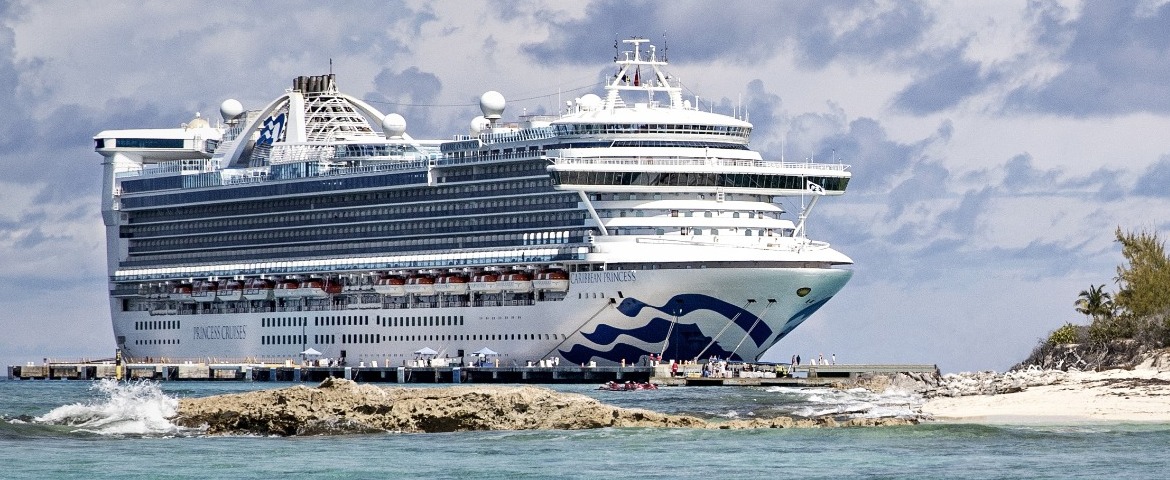
Cruise PCL Princess Caribbean ship

Caribbean Princess

3140 Passengers
112894 tons
Visit the ship's page

Port of Runavík, Faroe Islands | Cruise Port Guide

The ship slowly sails up Skálafjørður, a long arm of the sea cutting into the island of Eysturoy in the Faroe Islands. On either side: green slopes streaked with waterfalls, isolated farms, sheep clinging to improbable hillsides. Then Runavík appears: a string of colourful houses stretched along the shore, a pier right in the centre, mountains as a backdrop. No transfer here: you step directly into the village.

A village by the water

The main street runs along the fjord, between the church, a few shops and tiny gardens protected from the wind by low walls. The small local museum, set in an old house, evokes life in times past: fishing, wool, endless winters. You greet residents tending their gardens or repairing a boat; Faroese hospitality is reserved but warm, like these islands where everyone knows each other. On the water, floating rings mark the salmon farms, a pillar of the Faroese economy: the islands still live from the sea, just differently.

Toftavatn, the moorland and the birds

A leisurely half-hour walk from the pier, Lake Toftavatn lies in a landscape of heather moorland, rare in the archipelago. A trail circles it, among tufts of cotton grass and basalt outcrops. Oystercatchers and curlews make a great racket here in spring; on clear days, the neighbouring ridges are reflected in the dark water. It's the ideal walk to take in the Faroese silence, barely disturbed by the wind.

Walking above the fjord

More experienced hikers tackle the trails climbing to the heights, some of which follow old village paths. The effort is real and the weather changeable, but so is the reward: a bird's-eye view of Skálafjørður, the scattered farms and, in the distance, the silhouettes of the other islands. You come back down with the feeling of having walked on the roof of the North Atlantic. Ask before setting out: some trails cross private land and simply require you to close the gates behind you.

Farther afield on Eysturoy

Excursions let you explore further: the village of Gjógv, to the north, nestled against a natural gorge that serves as a harbour; mountain roads skirting the archipelago's highest peaks; or the undersea tunnel linking Eysturoy to the capital, famous for its roundabout carved beneath the fjord, the first of its kind in the world. In Leirvík, the Toftanes site bears witness to the Viking presence in the islands. The roads themselves are part of the journey: every bend opens onto a hanging valley, a hamlet with turf roofs, a waterfall plunging straight into the sea.

Practical pointers

  • Docking in the centre of the village: shops, local wool sweaters and the main street a few minutes' walk away.
  • Lake Toftavatn: an easy loop of about one to two hours from the pier.
  • Unsettled weather: dress in layers and bring a waterproof windbreaker.
  • Currency: Faroese króna (Danish krone accepted); cards accepted everywhere.

Sailing back down the fjord

On departure, the ship glides once again between the green slopes, and Runavík shrinks to a line of colours at the foot of the mountains. What remains of this port call is a feeling of pure air and space, the memory of a dark lake surrounded by heather and the certainty that the Faroes are like no other archipelago. The changing light of Skálafjørður stays with you for a long time.

Frequently Asked Questions

At the quay, right in the middle of the village. There is no transfer: you step straight into Runavík, on the shore of Skálafjørður, the long inlet that cuts into the island of Eysturoy.
Green slopes streaked with waterfalls, isolated farms, sheep clinging to improbable hillsides, then Runavík: a string of coloured houses stretched along the shore, mountains behind.
Follow the main street along the fjord, past the church, a few shops and tiny gardens sheltered from the wind by low walls. The small local museum, in an old house, evokes life in earlier times: fishing, wool, endless winters.
Salmon farming pens, a pillar of the Faroese economy. The islands still live from the sea, simply in a different way than in the days of cod.
A lake set in heather moorland, rare in the archipelago, half an hour's easy walk from the quay. A path circles it between tufts of cotton grass and basalt outcrops.
One to two hours from the quay, on easy ground. Oystercatchers and curlews make a racket there in spring; on a clear day the neighbouring ridges are mirrored in the dark water.
Yes, on the paths climbing to the heights, some of them following old village routes. The effort is real and the weather changeable, but the view drops over Skálafjørður and its scattered farms. Ask before setting out: some paths cross private land and simply require closing the gates behind you.
The village of Gjógv in the north, tucked against a natural gorge that serves as its harbour; the mountain roads skirting the archipelago's highest peaks; the subsea tunnel to the capital, famous for its roundabout carved beneath the fjord, the first of its kind in the world; and the Viking site of Toftanes at Leirvík.
Reserved but warm, in the manner of islands where everyone knows everyone. A nod to residents gardening or mending a boat is often enough to start a conversation.
Layers, with a waterproof windbreaker. The weather is unsettled in every season. The currency is the Faroese króna, the Danish króna is accepted, and cards work everywhere.